Contact us!

[Page created in 2024 for translation of original content]
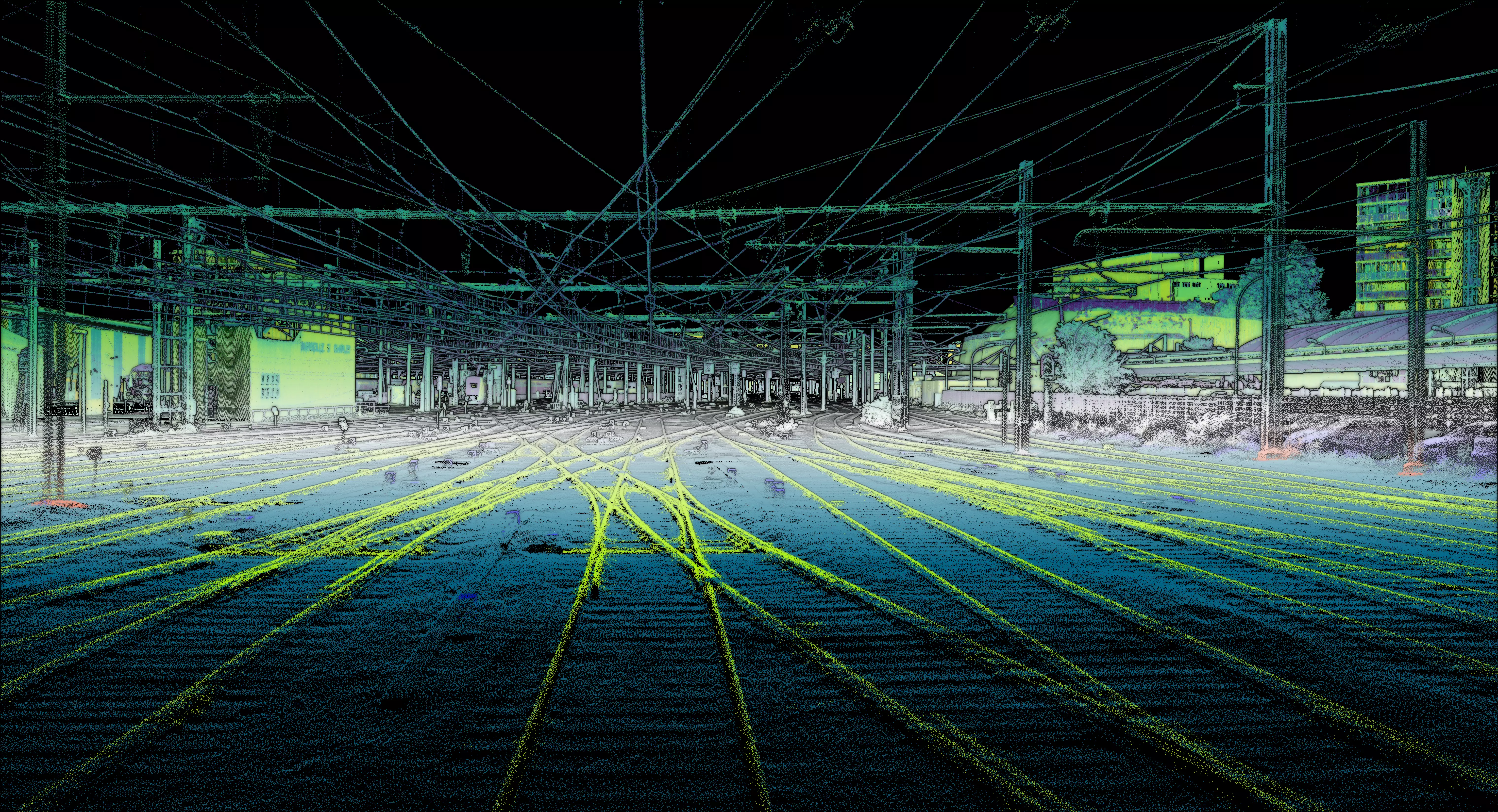
Democratized since 2017 with the creation of Altametris among all our clients, multi-echo LiDAR technology allows for detecting what lies beneath the trees.
In the case of managing and maintaining industrial installations, this technology proves particularly effective in obtaining the most precise and comprehensive knowledge possible of the condition of installations.
Indeed, laser remote sensing makes it possible to measure and map objects and structures, even those concealed by vegetation. We have used this technique notably to carry out a topographic survey in the area of the Prémol road bridge.
Prémol road bridge: a terrestrial survey possible but risky
In heavily vegetated areas, access to installations and their inspection remains possible most of the time.
In the case of our intervention, it would have been necessary to deploy teams with a terrestrial scanner around and directly on the structure.

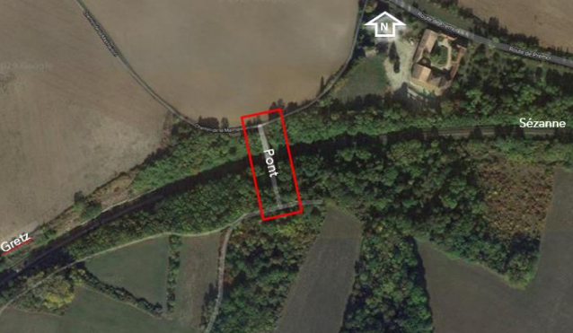
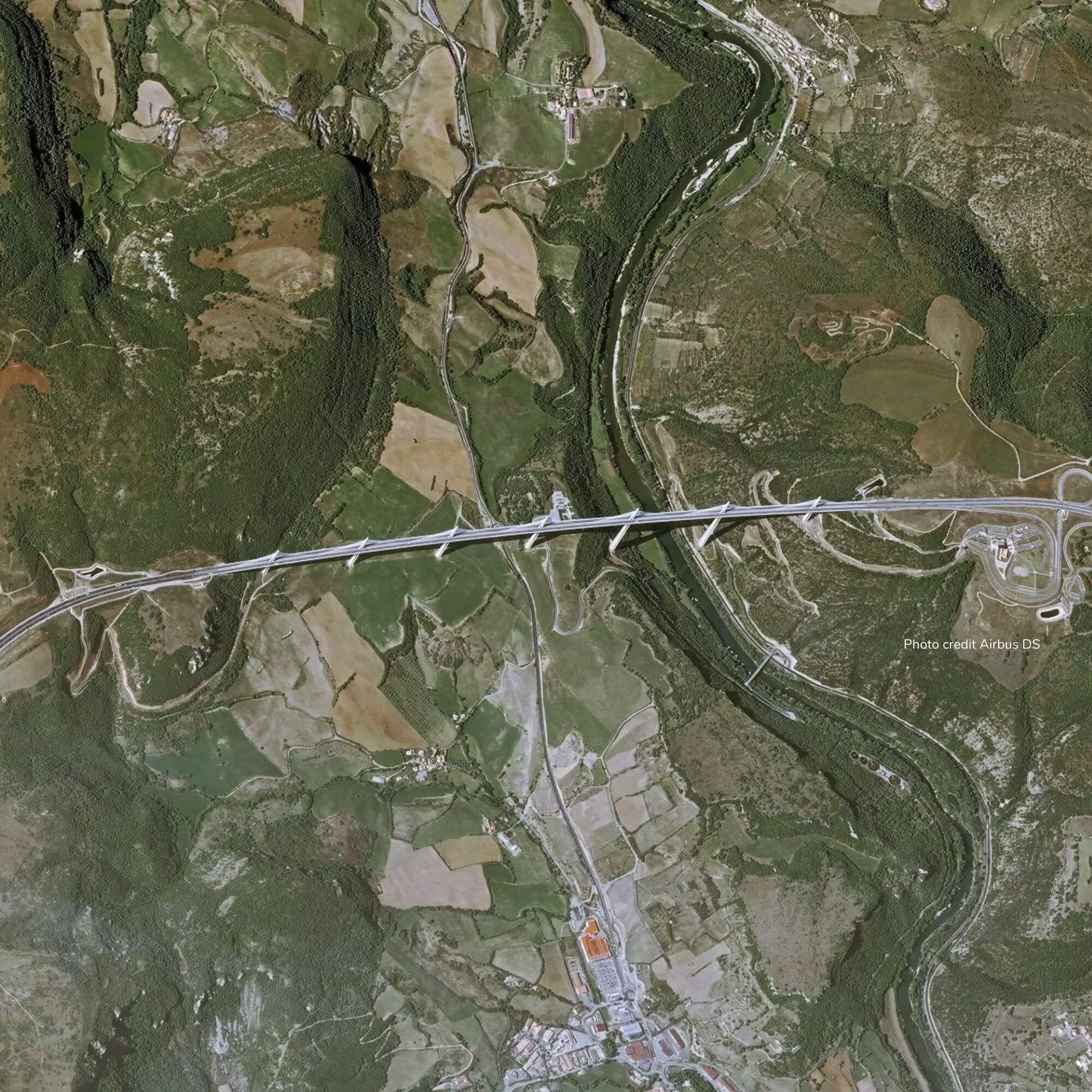
Intervention area for the topographic survey
Given the density of vegetation - including brambles - and the slope of the embankment, at least a full day would have been needed.
Since the structure is located on railway land, train traffic would also have had to be interrupted for the entire duration of the operation.
The terrestrial survey would therefore be a costly solution and would engage the safety of the agents in addition.
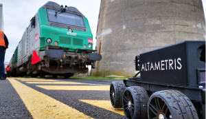
Drone use: an easy solution ?
In this context, the use of drones might seem like a miraculous solution to intervene safely and at lower cost. While this assertion is true, it should be noted that before any mission involving drone flight, it is necessary to submit an administrative request for flight authorization to the Directorate General of Civil Aviation (DGAC) to ensure the feasibility of the flight.
The pilot then creates a flight plan. And a few days before the mission, they check that the weather conditions are compatible with the flight.
Upon arrival at the site, the pilot conducts a prior joint inspection (ICP) in consultation with the client; they carry out a topographical survey of the area and secure the take-off perimeter. Finally, they can launch the drone.
While drone use is less time-consuming and more flexible, it remains an intervention that must be carried out by experienced professionals in compliance with safety standards and regulations.
Aerial LiDAR survey : quick intervention, quality deliverables
You will have understood, our client, the unified production area of Ile-de-France, wanted to carry out a topographic survey of the area before dismantling the structure.
The use of drones was imposed since it is less expensive and simpler to implement: without needing to interrupt rail traffic and without requiring announcer agents to ensure safety.
Indeed, in this half-hectare area, the vegetation cover is extremely dense, making a terrestrial inspection very complicated.
 In red, the area to be surveyed.
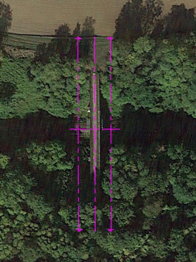
In pink, the axis marking plan for the production of the 4 sections.
In total, the topographic survey could be carried out in just 1 hour using a drone equipped with a multi-spectral LiDAR sensor.
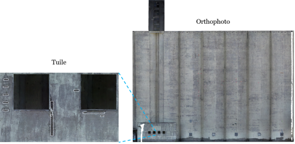
A few days later, we were able to provide our client with all the deliverables necessary for their analysis :
- 2D topographic plan scale 1/200th centimeter precision
- Report to the EPURE standard specific to the Public Rail Group in DWG format
- 2 elevation sections at 5 meters on each side of the structure
- 1 longitudinal section in the axis of the structure
- 1 cross-section
- LiDAR point cloud in Las 1.2 format
The data was delivered in the RGF93 CC49 geographic reference system for planimetry and NGF IGN69 for altimetry.
In conclusion, our client was able to obtain a precise and exhaustive deliverable very quickly and without having to mobilize heavy resources or interrupt rail traffic
Do you also want to use drones for your topographic surveys ?